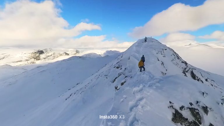
National mountain of Norway, and for a good reason! We went up and down the normal route, which really only has one grade 4-5 section. Good scrambling and a lot of hiking to get there.

|
1391m |
|
|
1525 m |
|
|
13 km |
|
|
13,5 h |
Start from the good parking spot by the sea. There is a clear path through the valley and up. Some route finding required to reach the first peak at 1314m. Some scrambling towards the end, but nothing too difficult.
The traverse involves some route finding. We ended up following quide with two clients which was good decision. Except that we ended up waiting for ages behind them in the climbing pitch. There is no room for passing and the spot proved to be quite challenging for people with no climbing experience. When cleared we moved past it with no difficulty. Grade 4+ seems correct, and the pitch is only a few moves.
Cruising to the top with some scrambling after that. On the way back climbing pitch is avoided by rappelling from the anchor little way past the climbing. After that just reverse your own steps.
Essential gear we had
More information
Topptur Förlat – Stetind and Narvik, a guide to selected climbs, 2008 – page 24

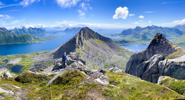
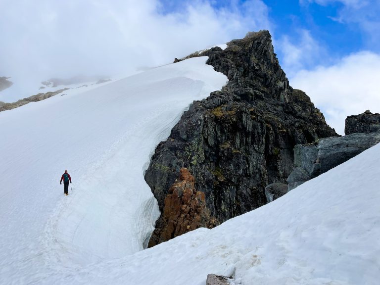
Beginnin of the hike in the valley. Stetind peak on the left. View from the first top towards the main peak. The climbing pitch of the route. Officially 4+. First food holds are quite far away, but the hand holds and cam placements are very good. In total about 5m of climbing. Waiting our turn to climb the pitch. This is definitely the bottleneck of the route on a busy day. One group (with double ropes) coming up from the climbing pitch and makin anchor. Multiple good options available. On the way back you move past the climbing pitch and rappel down from good anchor point. Orange helmet in the rappel point, white climbing up the pitch. Good view of the travers back from the main peak. Going back down. There are snowfields year around. Ice axe and crampons are recommended in cold conditions.